


This tool determines the closest facility to an event, based on specified cost criteria as well as the cost of the routes between each pair of event-facility points. The input point layer represents facilities while stops/flags in the View represent the events. The Closest Facility tool calculates the routes that link the events with the closest facility.
To use this utility first load a line layer with a network topology. If the network topology has already been created for this layer then select the Load topology from previously generated network option from the Network menu, otherwise select Network|Generate network topology to create the topology.
It is advisable that no stops from previously generated routes be present in the View.
Load a point layer representing the facilities (e.g., the facilities might represent the locations of hospitals that could treat patients from a traffic accident).
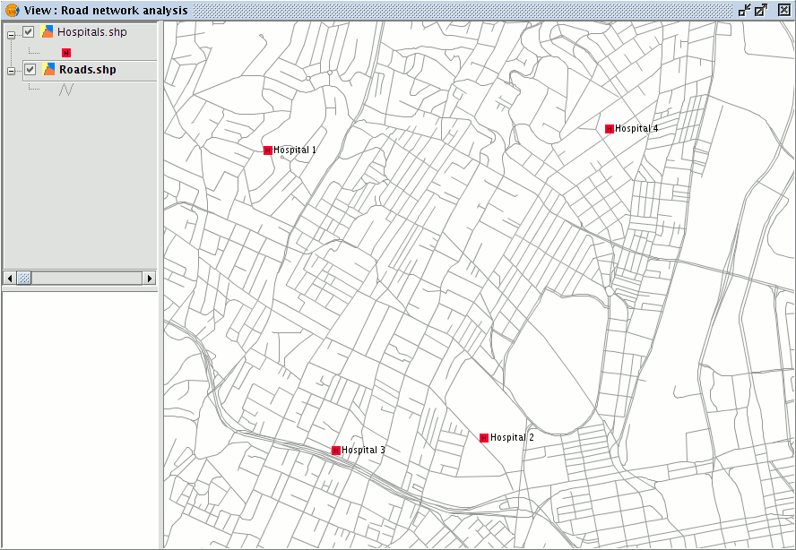
Network layer along with a layer of points (facilities)
If the event coordinates are known the Centre View to point tool can be used to centre the View on the event.
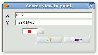
Centre View on the point
The event can then be defined as a stop in the Route control panel (highlight the line layer in the ToC and then choose Network|Manage stops) or may be placed directly into the View by using the tools on the Network toolbar.
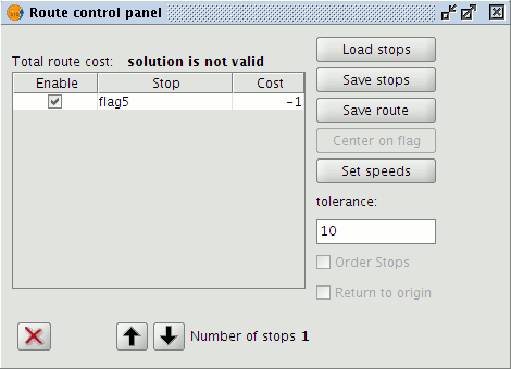
Managing stops (events)
To open the closest facility tool select Closest Facility from the Network menu.
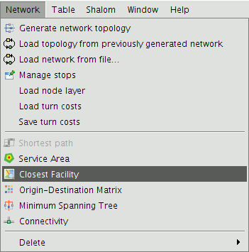
Closest Facility option on the Network menu
This opens a form containing a number of fields that must be filled in.
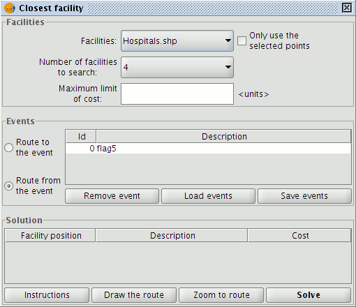
Form for configuring and calculating the closest facility to an event
In the Facilities section choose a facilities layer from the ToC, the number of facilities to search for, and the maximum cost limit to use (distance in metres).
NOTE: It is possible to use only those facilities that have been selected in the layer, or to specify the number to search for if none have been selected.
In the Events section select the event (e.g. of the accident), choose whether the route should be to the event or from the event, and then click the Solve button.
The application displays the possible solutions that meet the requirements. Facilities that do not meet the requirements are discarded. If a solution is selected in the Solution section it is possible to display the route Instructions, Draw the route in the View, and to Zoom to the route.
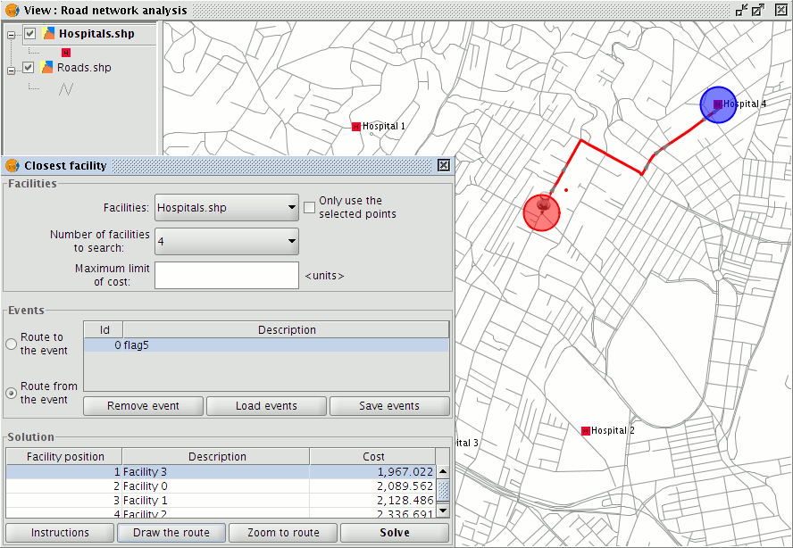
Display of the facility closest to the event and the shortest path between them


